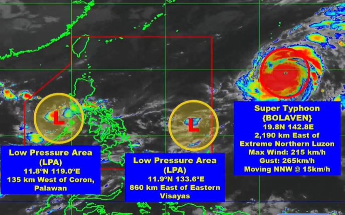
TWO low pressure areas (LPAs) inside the Philippine Area of Responsibility (PAR) are being closely monitored by the Philippine Atmospheric Geophysical and Astronomical Services Administration (Pagasa).
However, none of these weather disturbances would escalate into a tropical depression over the next few days, Pagasa weather specialist Patrick del Mundo said.
The state-run weather agency said in a 5 a.m. advisory that the first LPA was spotted some 860 kilometers east of Eastern Visayas while the other was at 135kms west of Coron, Palawan.
Meanwhile, the tropical cyclone – Super Typhoon 'Bolaven' (international name) - which has been hovering for days outside PAR was estimated some 2, 190kms east of extreme Northern Luzon.
"While Bolaven has a slim chance to enter PAR and directly affect the country, it may absorb the LPAs inside PAR in the coming days," Del Mundo said.
Pagasa said the LPAs are affecting Bicol Region, Mimaropa (Mindoro, Marinduque, Romblon and Palawan), Quezon, Northern Samar and Eastern Samar where overcast skies with scattered rain showers and thunderstorms will prevail within 24 hours.
Metro Manila and the rest of the country will have partly cloudy to cloudy skies with isolated downpours and thunderstorms due to the localized thunderstorms, especially in the afternoon or at night, the state weather bureau said.

